
Platform change for the “Service Status” Application Developed by Geosystems.
Platform change for the “Service Status” Application Developed by Geosystems.

Platform change for the “Service Status” Application Developed by Geosystems.

Professional Technical Support and Corrective Services for the FiberGIS® Product Implemented in BT LATAM.

Computer and Process Reengineering of the Cadastral Management System of the Province of Chaco – PFGP-63-SBCC-CF-3 – IDB Loan 3835/OC-AR (In Progress)

Implementation of the GIS Architecture proposed by Geosystems in the Design Report and Strategic Plan

Development and Maintenance of Geographic Information Systems Implementation Plan (In Progress)

Deployment and implementation of FiberGIS®, the Fiber Optic Network Management System from Geosystems
Super, a cable and telecommunication company, trusted in Geosystems a complete assessment of their GIS architecture, and the elaboration of a complete Strategic Plan. Currently Geosystems is executing the first implementation project addressed in the strategic plan

Census of the Urban Road Wood of the Metropolitan Area of Mendoza – UNICIPIO. Design and implementation of an information and management system, for modern management and planning of said Wood.

Comprehensive cadastral management system to improve and optimize the management of the General Directorate of Cadastre and Cartography of the Province of Currents (DG—CyC).
The project covers the comprehensive updating of cadastral management systems, economic cadastre, physio-parcelar data, as well as the factual status of the real estate, and includes document digitization processes, training to users and future system administrators and post-implementation technical support.

Reconversion of the Exploitation (Stage I) and Cadastral Management (Stage II) modules of AySA’s current Geographic Information System (GIS) to a new open technology platform, including data migration between the operating system and the one obtained as a result of this project.
From images of photogrammetric flights of the City of Buenos Aires, semi-automatic processes were carried out to detect possible changes in the buildings in order to keep the AySA Cadastral System up to date.

Technological Update of the FiberGIS® system, developed by Geosystems SA, which uses BT LATAM for the cadastre of its fiber optic network since 2003.

Update and Cadastral Modernization of Trelew Municipality, Chubut Province.

Implementation of a Territorial Information System in the Direction of Cadastre of the Province of Córdoba to manage graphic and alphanumeric information regarding the rural and urban plots that make up its territory. He contemplated integration with all his delegations and with other agencies such as Province Revenues, the Land Registry and SUAC.
The project consisted of the technological update of the Cadastral Management System, including DB engine upgrade, WEB application settings, new reports, new geographic visualizer, change of spatial data access architecture, updating of graphical editing software and configurations in interfaces with other systems.

Implementation of the GeoAVL platform with the aim of giving the customer a localization and tracking solution to meet the needs of their own and those of their customers. This system allows you to have a comprehensive application of AVL (Automatic Vehicle Location), on which you can develop particular applications for each client and integrations with their management systems.

Project of Modernization of Municipal Management aimed at promoting the Municipality of Avellaneda towards a Digital Government scheme, based on a strong Development of its Human Resources and based on obtaining a greater collection from the application of Information Technologies and management tools.

Modernization project of Municipal Management aimed at promoting the Municipality of Berazategui towards a Digital Government scheme, based on a strong Development of its Human Resources and based on obtaining a greater collection from the application of Information Technologies and management tools.
Survey, analysis and development of a Geographic Information System for the monitoring and control of works, the monitoring of these with respect to the Expansion Master Plan of the company.
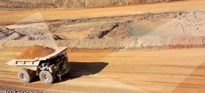
The objective of the project was to obtain a modern rural cadastre for Chubut Province, as requested by the Direction General of Cadastre and Territorial Information through the Ministry of Economy and Public Credit (Notes No. 52/11 and 62/11 DGCeIT).

Survey and elaboration of the cadastral mapping of an area of 35km2, the determination of the area built on each plot and the implementation of a modern and efficient Cadastral Geographic Information System, which allows to manage the graphic and alphanumeric information related to all plots, construction contours and the area associated with each of them.

Migrate available spatial data to a standard Open Geospatial Consortium (OGC) format that allows Aguas Santafesinas to use the new software versions available within the Hexagon Geospatial product suite and other products on the market.
“State of Situation” is a mobile decision support system, geographically representing the status of the various operational variables necessary for the management of water and sewer networks throughout the company concession, covering CABA and several partidos of Gran Buenos Aires.
Implementation of the Territorial Information System of the Direction of Cadastre of the province of Chubut for the administration of graphic and alphanumeric information relating to the rural and urban plots that make up its territory and integrating other provincial organisms such as Rentas of the Province and the Registry of Provincial Property, as well as with 23 of its municipalities.
Modernization of the Management of the Directorate General of Cadastral and Territorial Information of Chubut Province. BIRF Loan No. 7352-AR.
The scope of the project was to integrate the GIS and SAP platforms, so that the geographic information platform can directly access the data stored in SAP. In addition, dump the cartographic information available to TGN.
Provision of support and corrective maintenance service and evolutionary maintenance of geographic information systems applications, including mobile applications.
From satellite images, semi-automatic processes were carried out to identify possible changes in buildings in 65,000 blocks of the Conurbano Bonaerense.

Project part of the Modernization Program of Municipal Management of Maipú, consisted of implementing the Integral Territorial Management System (ITMS) in the Municipality integrating other municipal organism to manage graphical and alphanumeric information, allowing it to be kept up-to-date, consistent and standardized and easily accessible to users (external and internal) and key informants.
Implementation of the GeoAVL platform with the aim of giving the customer a localization and tracking solution to meet their needs. This system allows you to have a comprehensive application of AVL (Automatic Vehicle Location).

Provision of Hexagon AB and Autodesk Product Licenses and Support.

Implementation of a set of geomatic tools (tools used to store, create, use and share Geographical Information –GI-, local or web), which allowed municipalities and communes access to the provincial and national geographical information base, as well as to be able to generate their own GI for better service to citizens and the correct management of their territory.
Implementation of a Geographic Information System that links information related to the quality and hydrometeorology of the Río de la Plata and facilitates access to the information corresponding to Georeferenced Measurement Points, quickly, clearly and uniquely, allowing in turn to carry out queries and analyses with different output formats.
Implementation of geosystems’ GeoMapps® product for mapping querying and field data taking.
Implementation of geosystems’ GeoMapps® product for mapping querying and field data taking.

Implementation of the FiberGIS system with its own adaptations for the exploitation of information by the Engineering area of COMSAT

The project consisted in the development and implementation of the Traffic Control System (SCT) and the provision of onboard hardware on all track mobiles for satellite positioning (GPS), data transmission over cellular network (GPRS) and satellite network, and a control panel for drivers.
Development and implementation of the system used by MEGATRANS for mobile monitoring with publication on the Internet of mobile information on vector mapping

This project aimed to implement in the Municipality of Quilmes a modern and efficient Territorial Information System that allowed to manage graphic and alphanumeric information related to all rural and urban plots of the Partido.

Implementation of the GeoAVL platform with the aim of giving the customer a localization and tracking solution to meet their needs. This system allows you to have a comprehensive application of AVL (Automatic Vehicle Location).

Provision of Hexagon Geospatial Product Licenses and Support.
Implementation of GeoMapps® in Telefónica Argentina.

Development and Implementation of a Territorial Information System linked to the company’s corporate Datawarehouse.

Implementation of the GeoAVL platform with the aim of giving the customer a localization and tracking solution to meet their needs. This system allows you to have a comprehensive application of AVL (Automatic Vehicle Location).

Provision of Urban Mapping for Telmex.

Provision of Hexagon Geospatial Licenses, Maintenance and Technical Support.
Finder of points of interest closest to a given address.
Conforming of a repository of the digital cartography of Telecom, used for all the informatic applications of the company.
Preparation of the infrastructure, material and monitoring of a training process in e-Learning mode.

Provision of professional services to regularize the legal status of EDENOR facilities located in private properties in the Metropolitan Area of Buenos Aires.
A group of professionals specializing in Autodesk tools and Oracle Spatial database were made available to AySA to perform mapping construction and maintenance, activity is conducted in AySA offices, and is overseen by a Geosystems coordinator who interacts with the customer.

Survey and study in relation to the affectation and constitution of the easement of electroducts of electrical installations owned by distributors and/or carriers.

Provision of hardware, basic software and implementation of a Geographic Information System pilot.

Systematization of the process of quality control of the information received from the distribution companies, in order to assure the community that: the published indicators, the credited compensations, the information to users, the levels of technical service and quality of the product delivered, the trade indicators, the subsidies granted, among others, are the actually provided and informed, according to the current regulatory framework.

Production of digital mapping for MetroGas containing the 22 bar pipeline network and tools for geographic analysis.

Development and Implementation of a Corporate Geographic Information System with provision of high-precision mapping and linked to MetroRED CRM
Implementation of the GeoAVL platform with the aim of giving the customer a localization and tracking solution to meet their needs. This system allows you to have a comprehensive application of AVL (Automatic Vehicle Location).
Provision of hardware, basic software and adaptation of restitution equipment for use in the GIS of the Province of Córdoba.
Implementation of a Registration Information System that provides full support to the Registry’s operator, its Delegations and the users of its services.

Implementation of the GeoAVL platform with the aim of giving the customer a localization and tracking solution to meet their needs. This system allows you to have a comprehensive application of AVL (Automatic Vehicle Location).

Provision of Hexagon Geospatial Software Maintenance and Technical Support.
Provision of Urban Mapping.
Provision of Hexagon Geospatial Licenses, Maintenance and Technical Support.
Provision of licenses for Hexagon Geospatial and Autodesk products.

Survey, analysis, development and implementation of a solution to improve the quality of the service of Public Collective Transport (TPC) in the City of Posadas, through actions on operator control and user information, thus seeking to improve passenger satisfaction and attract a greater number of trips to the TPC. Provision and installation of the necessary infrastructure.
Development of New Modules, New Functions or Major Changes on the Geographic Information System.

Implementation of the Geographic Information System of the Municipality of Esteban Echeverría (Province of Buenos Aires).

Development of a set of computer applications necessary for the loading of data to the existing Geographic Information System in the Municipality of La Plata (Province of Buenos – Argentina).
Conversion of the data available to the Planning Direction and its incorporation into the Corporate Territorial Information System of the Municipality of the City of La Plata (Province of Buenos Aires).
Comparison of existing data in the Cadastral Information System for debugging.
Provision of hardware, base software; parameterization and application settings for the operation of the Geographic Information System of the Municipality of La Plata.

Update of the cadastre of users of the concession area corresponding to the company Aguas Argentinas S.A.

Development and implementation of a financial market geographic analysis system and classification of commercial prospects.

Complete survey of the City of Buenos Aires consisting of 320,000 plots on an area of 20,000 ha. Including the categorization and valuation of 1,500,000 tax units.
Design, development and implementation of a system for the management of the permits of works carried out on public roads by service providers.
Design and creation of the geographical database for the Municipality of Venado Tuerto (Province of Santa Fe) and the development of programs for its visualization and treatment.
Construction of a 543-point mining geodesic network, in the provinces of Santa Cruz, Tierra del Fuego and Chubut.
Inspection of the work of the Project “Implementation of a Territorial Information System and Reorganization of the Cadastre of the Province of Corrientes”.

Provision of equipment, basic software and consulting services for the commissioning of the Geographic Information System of the Province of Formosa
Development and implementation of a Territorial Information System for the Cadastre Directorate of the Province of Formosa
Provision of equipment, basic software and consulting services for the commissioning of the Geographic Information System of the Province of Misiones (República Argentina).
Field measurements, data collection and urban census to update existing information in the Province Cadastre of Misiones
Computer Maintenance and Management of Data Capture Tasks in the Cadastral Directorate of the Province of Misiones.
Informatization of the Property Registry by developing a system adjusted to the requirements of registration and making the modifications of the processes affected by the installation of the Registration Information System
Design and Development of the Geographic Information System for the Cadastre Directorate of the Province of Misiones

Inspection of the Making of the Cartographic Base, of the Cadastral Mapping and integration to the Geographic Information System of the Province of Salta

Supervision and Inspection of the tasks that integrated the RECAT Project – Restructuring of the Cadastral System of the Province of Tucumán.

Preparation of a report with the status of geographical information management.
Maintenance services on the Cadastral Information System, Training and Technical Assistance.
Within the framework of the Municipal Management Modernization Project, of the Municipality of Avellaneda, a georeferenced mapping base of the entire Municipal territory was built.