
Platform change for the “Service Status” Application Developed by Geosystems.
Platform change for the “Service Status” Application Developed by Geosystems.

Platform change for the “Service Status” Application Developed by Geosystems.

Professional Technical Support and Corrective Services for the FiberGIS® Product Implemented in BT LATAM.

Computer and Process Reengineering of the Cadastral Management System of the Province of Chaco – PFGP-63-SBCC-CF-3 – IDB Loan 3835/OC-AR (In Progress)

Implementation of the GIS Architecture proposed by Geosystems in the Design Report and Strategic Plan

Deployment and implementation of FiberGIS®, the Fiber Optic Network Management System from Geosystems
Super, a cable and telecommunication company, trusted in Geosystems a complete assessment of their GIS architecture, and the elaboration of a complete Strategic Plan. Currently Geosystems is executing the first implementation project addressed in the strategic plan

Census of the Urban Road Wood of the Metropolitan Area of Mendoza – UNICIPIO. Design and implementation of an information and management system, for modern management and planning of said Wood.

Comprehensive cadastral management system to improve and optimize the management of the General Directorate of Cadastre and Cartography of the Province of Currents (DG—CyC).
The project covers the comprehensive updating of cadastral management systems, economic cadastre, physio-parcelar data, as well as the factual status of the real estate, and includes document digitization processes, training to users and future system administrators and post-implementation technical support.

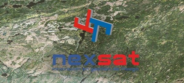
Technological Update of the FiberGIS® system, developed by Geosystems SA, which uses BT LATAM for the cadastre of its fiber optic network since 2003.

Implementation of the GeoAVL platform with the aim of giving the customer a localization and tracking solution to meet the needs of their own and those of their customers. This system allows you to have a comprehensive application of AVL (Automatic Vehicle Location), on which you can develop particular applications for each client and integrations with their management systems.
Survey and elaboration of the cadastral mapping of an area of 35km2, the determination of the area built on each plot and the implementation of a modern and efficient Cadastral Geographic Information System, which allows to manage the graphic and alphanumeric information related to all plots, construction contours and the area associated with each of them.
Implementation of the GeoAVL platform with the aim of giving the customer a localization and tracking solution to meet their needs. This system allows you to have a comprehensive application of AVL (Automatic Vehicle Location).

Implementation of a set of geomatic tools (tools used to store, create, use and share Geographical Information –GI-, local or web), which allowed municipalities and communes access to the provincial and national geographical information base, as well as to be able to generate their own GI for better service to citizens and the correct management of their territory.

Implementation of a Geographic Information System that links information related to the quality and hydrometeorology of the Río de la Plata and facilitates access to the information corresponding to Georeferenced Measurement Points, quickly, clearly and uniquely, allowing in turn to carry out queries and analyses with different output formats.

Implementation of geosystems’ GeoMapps® product for mapping querying and field data taking.
Implementation of geosystems’ GeoMapps® product for mapping querying and field data taking.
Development and implementation of the system used by MEGATRANS for mobile monitoring with publication on the Internet of mobile information on vector mapping

Implementation of the GeoAVL platform with the aim of giving the customer a localization and tracking solution to meet their needs. This system allows you to have a comprehensive application of AVL (Automatic Vehicle Location).

Implementation of GeoMapps® in Telefónica Argentina.

Implementation of the GeoAVL platform with the aim of giving the customer a localization and tracking solution to meet their needs. This system allows you to have a comprehensive application of AVL (Automatic Vehicle Location).
Implementation of the GeoAVL platform with the aim of giving the customer a localization and tracking solution to meet their needs. This system allows you to have a comprehensive application of AVL (Automatic Vehicle Location).

Implementation of the GeoAVL platform with the aim of giving the customer a localization and tracking solution to meet their needs. This system allows you to have a comprehensive application of AVL (Automatic Vehicle Location).