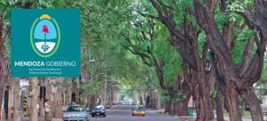
Professional Technical Support and Corrective Services for the FiberGIS® Product Implemented in BT LATAM.
A geographical information management and display platform implemented entirely on the web, designed for the use and processing of any type of data source (databases, document library, geographical files and image servers, among others).
It contains specific modules for several types of businesses, such as public service distribution, land management, or the monitoring and management of remote sensors and fleets. Moreover, it offers the possibility of extending your capabilities according to the specific requirements of each implementation.
Technical characteristics:
Professional Technical Support and Corrective Services for the FiberGIS® Product Implemented in BT LATAM.
Comprehensive cadastral management system to improve and optimize the management of the General Directorate of Cadastre and Cartography of the Province of Currents (DG—CyC).
The project covers the comprehensive updating of cadastral management systems, economic cadastre, physio-parcelar data, as well as the factual status of the real estate, and includes document digitization processes, training to users and future system administrators and post-implementation technical support.
Census of the Urban Road Wood of the Metropolitan Area of Mendoza – UNICIPIO. Design and implementation of an information and management system, for modern management and planning of said Wood.
Computer and Process Reengineering of the Cadastral Management System of the Province of Chaco – PFGP-63-SBCC-CF-3 – IDB Loan 3835/OC-AR (In Progress)
Monday to Friday, from 9 am to 6 pm
Esteban de Luca 2223 (C1246ABS), Ciudad Autónoma de Buenos Aires – Argentina
GeoAVL, GeoSITM and FiberGIS are registered trademarks of Geosystems S.A.
Hexagon is a registered trademark of Hexagon AB.