
Cambio de Plataforma de la Aplicación Estado de Servicio

Cambio de Plataforma de la Aplicación “Estado de Servicio” Desarrollada por Geosystems
Servicios Profesionales de Soporte Técnico y Correctivo de FiberGIS®

Servicios Profesionales de Soporte Técnico y Correctivo al Producto FiberGIS® Implementado en BT LATAM
Reingeniería informática y de procesos del Sistema de Gestión Catastral de la Provincia del Chaco – PFGP-63-SBCC-CF-3 – Préstamo BID 3835/OC-AR (En Ejecución)

Reingeniería informática y de procesos del Sistema de Gestión Catastral de la Provincia del Chaco – PFGP-63-SBCC-CF-3 – Préstamo BID 3835/OC-AR (En Ejecución)
Implementación de la Arquitectura GIS Propuesta en el Informe de Diseño y Plan Estratégico

Implementación de la Arquitectura GIS propuesta por Geosystems en el Informe de Diseño y Plan Estratégico.
Servicio de Desarrollo y Mantenimiento del Plan de Implementación de Sistemas de Información Geográfica (en ejecución)

Desarrollo y Mantenimiento del Plan de Implementación de los Sistemas de Información Geográfica (En ejecución)
Implementación del Sistema de Administración de Fibra Óptica FiberGIS®

Implementación del Sistema de Administración de Fibra Óptica FiberGIS® de Geosystems
Provisión de servicios y software para una nueva arquitectura GIS
Provisión a Super del software y los servicios necesarios para implementar una nueva Arquitectura GIS, propuesta en el Informe de Diseño y Plan Estratégico que elaboró previamente Geosystems (En Ejecución)
Sistema de Información y Gestión del Arbolado Público del Área Metropolitana de Mendoza – UNICIPIO (en ejecución)

Censo del Arbolado Urbano Viario del Área Metropolitana de Mendoza – UNICIPIO. Diseño e implementación de un sistema de información y gestión, para un moderno manejo y planificación de dicho Arbolado.
Sistema de Gestión y Visualización de Móviles – Municipalidad de Avellaneda
Implementación de la plataforma GeoAVL con el objetivo de darle al cliente una solución de localización y seguimiento para cubrir sus necesidades. Este sistema le permite disponer de una aplicación integral de AVL (Automatic Vehicle Location).
Actualizaciones sobre las Aplicaciones GIS

Desarrollo de Nuevos Módulos, Nuevas Funciones o Cambios Mayores sobre el Sistema de Información Geográfico.
Provisión de Licencias, Mantenimiento y Soporte Técnico

Provisión de Licencias Hexagon Geospatial, Mantenimiento y Soporte Técnico.
Desarrollo del Sistema GIS del Río de la Plata de AySA.
Implementación de un Sistema de Información Geográfica que vincula información relativa a calidad e hidrometeorología del Río de la Plata y facilita el acceso a la información correspondiente a Puntos de Medición Georreferenciados, en forma rápida, clara y unívoca, permitiendo a su vez realizar consultas y análisis con diferentes formatos de salida.
Detección de Indicios Constructivos Mediante Imágenes Satelitales para AySA S.A.
A partir de imágenes satelitales se realizaron procesos semi-automáticos para identificar posibles cambios en las edificaciones en 65.000 manzanas del Conurbano Bonaerense.
Detección de Indicios Constructivos de la Ciudad de Buenos Aires a Partir de Imágenes Aéreas para AySA S.A.
A partir de imágenes de vuelos fotogramétricos de la Ciudad de Buenos Aires se realizaron procesos semi-automáticos para detectar posibles cambios en las edificaciones con el fin de mantener actualizado el Sistema Catastral de AySA.
Provisión de Licencias, Mantenimiento y Soporte Técnico
Provisión de Licencias de los Productos de Hexagon Geospatial y Autodesk.
Provisión de Licencias, Soporte Técnico y Mantenimiento

Provisión de Licencias Hexagon Geospatial, Mantenimiento y Soporte Técnico.
Provisión de Licencias, Mantenimiento y Soporte Técnico

Provisión de Mantenimiento y Soporte Técnico de software de Hexagon Geospatial.
Provisión de Licencias Hexagon Geospatial, Mantenimiento y Soporte Técnico

Provisión de Licencias y Soporte de productos de Hexagon Geospatial.
Implementación de GeoMapps® en AySA
Implementación del producto GeoMapps® de Geosystems para la consulta de cartografía y toma de datos en campo.
Implementación de GeoMapps® en Telefónica de Argentina (Movistar)

Implementación de GeoMapps® en Telefónica Argentina.
Implementación de GeoMapps® en Aguas Santafesinas
Implementación del producto GeoMapps® de Geosystems para la consulta de cartografía y toma de datos en campo.
Actualización Tecnológica del Sistema de Información Geográfico de Aguas Santafesinas
Migrar los datos espaciales disponibles a un formato estándar del Open Geospatial Consortium (OGC) que le permita a Aguas Santafesinas, utilizar las nuevas versiones de software disponibles dentro de la suite de productos de Hexagon Geospatial y de otros productos del mercado.
Actualización del Estado Parcelario y Construcciones de la Ciudad de Trelew

Relevamiento y elaboración de la cartografía catastral de un área de 35km2, la determinación de la superficie construida en cada parcela y la implementación de un Sistema de Información Geográfico Catastral moderno y eficiente, que permite administrar la información gráfica y alfanumérica relativa a todas las parcelas, contornos constructivos y la superficie asociada a cada uno de ellos.
Servicio de Mantenimiento Evolutivo del Sistema de Información Geográfico de AySA
Provisión del servicio de soporte y mantenimiento correctivo y mantenimiento evolutivo de las aplicaciones de los sistemas de información geográfico, incluyendo las aplicaciones móviles.
Actualización Tecnológica del Sistema de Información Catastral de la Provincia de Córdoba

El proyecto consistió en la actualización tecnológica del Sistema de Gestión Catastral, incluyendo actualización del motor de DB, ajustes de aplicaciones WEB, nuevos reportes, nuevo visualizador geográfico, cambio de arquitectura de acceso a los datos espaciales, actualización del software de edición gráfica y ajustes en interfases con otros sistemas.
Actualización Tecnológica del Sistema de Gestión de Redes de Fibra Óptica

Actualización Tecnológica del sistema FiberGIS®, desarrollado por Geosystems SA, el cual utiliza BT LATAM para el catastro de su red de fibra óptica desde el año 2003.
Sistema Integral de Gestión y Actualización de la Información de la Dirección General de Catastro y Cartografía de la Provincia de Corrientes. Préstamo BID 3835/OC-AR
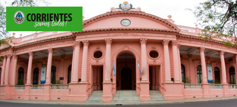
Sistema de gestión catastral integral para mejorar y optimizar la gestión de la Dirección General de Catastro y Cartografía de la Provincia de Corrientes (DGCyC).
El proyecto abarca la actualización integral de los sistemas de gestión catastral, los datos del catastro económico, del físico-parcelario, así como del estado de hecho de la propiedad inmueble, e incluye procesos digitalización de documentos, capacitación a usuarios y futuros administradores del sistema y el soporte técnico post-implementación.
Sistema de Información Geográfico de la Ciudad de Venado Tuerto

Diseño y creación de la base de datos geográfica para la Municipalidad de Venado Tuerto (Provincia de Santa Fe) y el desarrollo de programas para su visualización y tratamiento.
Sistema de Información Geográfico de EPEC (Empresa Provincial de Energía de la Provincia de Córdoba)

Provisión de hardware, software de base e implementación de un piloto del Sistema de Información Geográfica.
Sistema de Información Geográfico de la Provincia de Córdoba
Provisión de hardware, software de base y adaptación de equipos de restitución para utilización en el GIS de la Provincia de Córdoba.
Catastro de Aguas Argentinas

Actualización del catastro de usuarios del área de concesión de la empresa Aguas Argentinas.
Relevamiento Catastral de la Ciudad de Buenos Aires

Relevamiento completo de la Ciudad de Buenos Aires conformado por 320.000 parcelas en una superficie de 20.000 has. Incluyendo la categorización y valuación de 1.500.000 unidades fiscales.
Integración del Catastro de la Provincia de Misiones

Provisión de equipamiento, software de base y servicios de consultoría para la puesta en operación del Sistema de Información Geográfica de la Provincia de Misiones (República Argentina).
Integración del Sistema de Información Geográfica de la Provincia de Formosa

Provisión de equipamiento, software de base y servicios de consultoría para la puesta en operación del Sistema de Información Geográfica de la Provincia de Formosa.
Actualización del Catastro de la Provincia de Misiones
Mediciones de campo, recopilación de datos y censo urbano para actualizar la información existente en el Catastro de la Provincia de Misiones.
Sistema de Información Geográfico
Diseño y Desarrollo del Sistema de Información Geográfica para la Dirección de Catastro de la Provincia de Misiones.
Sistema de Información Territorial de la Provincia de Formosa
Desarrollo e implementación de un Sistema de Información Territorial para la Dirección de Catastro de la Provincia de Formosa.
Sistema de Catastro y Registro Minero – Región Sur – Sur

Construcción de una red geodésica minera de 543 puntos, en las provincias de Santa Cruz, Tierra del Fuego y Chubut.
Sistema para el Servicio 112 de Telecom Argentina

Buscador de puntos de interés más cercanos a un domicilio dado.
Sistema de Información Geográfico Corporativo

Desarrollo e Implementación de un Sistema de Información Geográfica Corporativo con provisión de cartografía de alta precisión y vinculado al CRM de MetroRED.
Sistema de Información Geográfica de Telecom Personal
Desarrollo e Implementación de un Sistema de Información Territorial vinculado al DataWarehouse corporativo de la compañía.
Aplicaciones para la Carga de Datos al SIT de la Ciudad de La Plata

Desarrollo de un conjunto de aplicaciones informáticas necesarias para la carga de datos al Sistema de Información Geográfico existente en la Municipalidad de La Plata (Provincia de Buenos – República Argentina).
Sistema de Información Geográfico

Implementación del Sistema de Información Geográfica de la Municipalidad de Esteban Echeverría (Provincia de Buenos Aires).
Mantenimiento y Captura del Catastro de la Provincia de Misiones
Mantenimiento Informático y Gerenciamiento de las tareas de captura de datos en la Dirección de Catastro de la Provincia de Misiones.
Sistema de Gestión de Permisos y Reclamos del Gobierno de la Ciudad de Buenos Aires
Diseño, desarrollo e implementación de un sistema para la gestión de los permisos de obras que realizan en la vía pública las empresas prestadoras de servicios.
Sistema de Gestión y Visualización de Móviles

Desarrollo e implementación del sistema utilizado por MEGATRANS para el monitoreo de móviles con publicación en Internet de la información de sus móviles sobre cartografía vectorial.
Sistema Único de Cartografía Telecom Argentina
Conformación de un repositorio único de la cartografía digital de Telecom, utilizable por todas las aplicaciones informáticas de la compañía.
Sistema de Gestión de Redes de Fibra Óptica de COMSAT

Implementación del sistema FiberGIS con adaptaciones propias para la explotación de información por parte del área de Ingeniería de COMSAT.
Conversión de Datos e Incorporación al SIT de la Municipalidad de La Plata
Conversión de los datos que disponía la Dirección de Planeamiento y su incorporación al Sistema de Información Territorial Corporativo de la Municipalidad de la Ciudad de La Plata (Provincia de Buenos Aires).
Sistema de Información Territorial de la Provincia de Córdoba – Catastro Provincial
Implementación de un Sistema de Información Territorial en la Dirección de Catastro de la Provincia de Córdoba para administrar información gráfica y alfanumérica relativa a las parcelas rurales y urbanas que componen su territorio. Contempló la integración con todas sus delegaciones y con otros organismos como Rentas de la Provincia, el Registro de la Propiedad y el SUAC.
Provisión de Recursos Humanos Especializados en la Construcción de Cartografía
Se puso a disposición de AySA un grupo de profesionales especializado en herramientas Autodesk y base de datos Oracle Spatial, para realizar la construcción y mantenimiento de cartografía, la actividad se desarrolla en oficinas de AySA y es supervisado por un coordinador de Geosystems que interactúa con el cliente.
Sistema de Información Geográfico e Integración con la Plataforma SAP
El alcance del proyecto fue integrar las plataformas GIS y SAP, de modo de posibilitar directamente de la plataforma de información geográfica acceder a los datos almacenados en SAP. Adicionalmente volcar la información cartográfica que disponía TGN.
Sistema de Gestión y Visualización de Móviles

Implementación de la plataforma GeoAVL con el objetivo de darle al cliente una solución de localización y seguimiento para cubrir sus necesidades. Este sistema le permite disponer de una aplicación integral de AVL (Automatic Vehicle Location).
Auditoría de las Servidumbres de Paso (Ente Nacional Regulador de la Electricidad)

Relevamiento y estudio con relación a la afectación y constitución de la servidumbre de electroductos de las instalaciones eléctricas propiedad de las Distribuidoras y/o Transportistas.
Informatización del Ente Regulador de la Electricidad de la Provincia de Río Negro (EPRE)

Sistematización del proceso de control de la calidad de la información recibida desde las empresas distribuidoras, con el objeto de garantizarle a la comunidad que: los indicadores publicados, las compensaciones acreditadas, la información a los usuarios, los niveles del servicio técnico y calidad del producto entregado, los indicadores comerciales, los subsidios otorgados, entre otros, son los realmente prestados e informados, de acuerdo lo exige el marco regulatorio vigente.
Sistema de Control de Tráfico Ferroviario

Desarrollo e implementación del Sistema de Control de Tráfico (SCT) y la provisión del hardware embarcado en todos los móviles de vía para el posicionamiento satelital (GPS), la transmisión de datos a través de la red celular (GPRS) y red satelital, y un panel de control para los conductores.
Sistema de Información Geográfica

Este proyecto tuvo como objetivo implementar en la Municipalidad de Quilmes un Sistema de Información Territorial moderno y eficiente que permitió administrar información gráfica y alfanumérica relativa a todas las parcelas rurales y urbanas del Partido.
Servicio de Capacitación en Modalidad e-Learnig
Preparación de la infraestructura, material y seguimiento de un proceso de capacitación en modalidad e-Learning.
Sistema de Información Geográfica para la Gestión de Obras
Relevamiento, análisis y desarrollo de un Sistema de Información Geográfico para el seguimiento y control de obras, el seguimiento de éstas respecto al Plan Director de Expansión de la compañía.
Sistema de Gestión y Visualización de Móviles
Implementación de la plataforma GeoAVL con el objetivo de darle al cliente una solución de localización y seguimiento para cubrir sus necesidades. Este sistema le permite disponer de una aplicación integral de AVL (Automatic Vehicle Location).
Sistema de Gestión de Transporte Público de la Ciudad de Posadas
Relevamiento, análisis, desarrollo e implementación de una solución para mejorar la calidad del servicio del Transporte Público Colectivo (TPC) en la Ciudad de Posadas, mediante acciones sobre el control de los operadores y la información al usuario, buscando de esta manera, mejorar la satisfacción de los pasajeros y atraer un mayor número de viajes al TPC. Provisión e instalación de la infraestructura necesaria.
Desarrollo de un Sistema Geográfico Móvil de Gestión
“Estado de Situación” es un sistema móvil de soporte a la toma de decisiones, representando de manera geográfica el estado de las distintas variables operativas necesarias para la gestión de las redes de agua y cloaca en toda la concesión de la empresa, que abarca CABA y varios partidos del Gran Buenos Aires.
Cartografía Digital para MetroGas

Producción de cartografía digital para MetroGas conteniendo la red de gasoducto de 22 bar y herramientas para el análisis geográfico.
Catastro Gráfico Rural de la Provincia del Chubut

El objetivo del proyecto fue obtener un catastro rural moderno para la Provincia de Chubut, de acuerdo a lo solicitado por la Dirección General de Catastro e Información Territorial a través del Ministerio de Economía y Crédito Público (Notas Nº 52/11 y 62/11 DGCeIT).
Infraestructura de Gestión Geográfica y Geocodificación de Domicilios de la Provincia de Santa Fe

Implementación de un conjunto de herramientas geomáticas (herramientas que se usan para almacenar, crear, usar y compartir Información Geográfica –IG-, locales o en web), que le permitió a las municipalidades y comunas el acceso a la base de Información Geográfica provincial y nacional, como así también poder generar su propia IG para un mejor servicio a los ciudadanos y la correcta gestión de su territorio.
Gestión Territorial, Actualización del Registro Gráfico Parcelario y Valuaciones Fiscales de la Provincia del Chubut. Informatización de 23 Municipios de la Provincia
Implementación del Sistema de Información Territorial de la Dirección de Catastro de la provincia del Chubut para la administración de la información gráfica y alfanumérica relativa a las parcelas rurales y urbanas que componen su territorio e integrando otros organismos provinciales como Rentas de la Provincia y el Registro de la Propiedad Provincial, así como también con 23 de sus Municipios.
Gestión Territorial. Integración con el Catastro Provincial

Actualización y Modernización Catastral del Municipio de Trelew, Provincia del Chubut.
Sistema integrado de Información Territorial para la Modernización de la Gestión Municipal

Proyecto enmarcado dentro del Programa de Modernización de la Gestión Municipal de Maipú, consistió en implementar el Sistema Integral de Gestión Territorial (SIGT) en el Municipio integrando a otros organismos municipales para administrar información gráfica y alfanumérica, permitiendo mantenerla actualizada, consistente y estandarizada y fácilmente accesible a los usuarios (externos e internos) e informantes claves.
Provisión de Licencias, Soporte Técnico y Mantenimiento
Provisión de Licencias y Soporte de productos de Hexagon AB y Autodesk.
Sistema de Gestión y Visualización de Móviles

Implementación de la plataforma GeoAVL con el objetivo de darle al cliente una solución de localización y seguimiento para cubrir sus necesidades. Este sistema le permite disponer de una aplicación integral de AVL (Automatic Vehicle Location).
Sistema de Gestión y Visualización de Móviles

Implementación de la plataforma GeoAVL con el objetivo de darle al cliente una solución de localización y seguimiento para cubrir sus necesidades. Este sistema le permite disponer de una aplicación integral de AVL (Automatic Vehicle Location).
Sistema de Gestión y Visualización de Móviles

Implementación de la plataforma GeoAVL con el objetivo de darle al cliente una solución de localización y seguimiento para cubrir necesidades propias y las de sus clientes. Este sistema le permite disponer de una aplicación integral de AVL (Automatic Vehicle Location), sobre la cual puede desarrollar aplicaciones particulares para cada cliente e integraciones con sus sistemas de gestión.
Sistema de Información Territorial de la Provincia del Chubut – Catastro Provincial
Modernización de la Gestión de la Dirección General de Catastro e Información Territorial de la Provincia de Chubut. Préstamo BIRF N° 7352-AR.
Diagnostico de Situación y Diseño del Mapa Estratégico del Sistema de Información Geográfico Corporativo

Elaboración de un informe con el estado de situación de la gestión de la información geográfica.
Depuración de Bases de Datos, Censo e Inspección.
En el marco del Proyecto de Modernización de la Gestión Municipal, de la Municipalidad de Avellanada, se construyo una base cartográfica georeferenciada de todo el territorio Municipal.
Servicios de Mantenimiento al Sistema de Información Territorial de la Dirección General de Catastro de la Provincia de Córdoba
Servicios de mantenimiento sobre el Sistema de Información Catastral, Capacitación y Asistencia Técnica.
Regularización de Servidumbres

Prestación de servicios profesionales para regularizar la situación jurídica de las instalaciones de EDENOR emplazadas en propiedades privadas en el Área Metropolitana de Buenos Aires.
Migración GIS y Módulos de Explotación, Gestión Catastral e Interfaces – AySA
Reconversión de los módulos de Explotación (Etapa I) y de Gestión Catastral (Etapa II) del actual Sistema de Información Geográfica (SIG) de AySA a una nueva plataforma tecnológica abierta, incluyendo la migración de datos entre el sistema operativo y el que se obtuvo como resultado de este proyecto.
Modernización de Gestión Municipal de Berazategui – Sistema de Información Catastral

Proyecto de Modernización de la Gestión Municipal dirigido a impulsar a la Municipalidad de Berazategui hacia un esquema de Gobierno Digital, basado en un fuerte Desarrollo de sus Recursos Humanos y sustentado en la obtención de una mayor recaudación a partir de la aplicación de Tecnologías de Información y herramientas de gestión.
Provisión de Cartografía para Telmex Argentina

Provisión de Cartografía Urbana para Telmex.
Modernización de Gestión Municipal de Avellaneda – Sistema de Información Catastral
Proyecto de Modernización de la Gestión Municipal dirigido a impulsar a la Municipalidad de Avellaneda hacia un esquema de Gobierno Digital, basado en un fuerte Desarrollo de sus Recursos Humanos y sustentado en la obtención de una mayor recaudación a partir de la aplicación de Tecnologías de Información y herramientas de gestión.
Provisión de Cartografía para Telecom Argentina
Provisión de Cartografía Urbana.
Sistema de Información Registral de la Provincia de Córdoba – Registro de la Propiedad
Implementación de un Sistema de Información Registral que brinda total soporte a la operatoria del Registro, a sus Delegaciones y a los usuarios de sus servicios.
Inspección del Proyecto Catastral de la Provincia de Salta

Inspección de la Confección de la Base Cartográfica, de la Cartografía Catastral e integración al Sistema de Información Geográfico de la Provincia de Salta.
Plataforma de Visualización y Análisis de Prospectos Comerciales del Banco Credicoop

Desarrollo e implementación de un sistema de Análisis Geográfico del mercado financiero y clasificación de prospectos comerciales.
Inspección del Proyecto Catastral de la Provincia de Corrientes
Inspección de las actividades del Proyecto “Implementación de un Sistema de Información Territorial y Reorganización del Catastro de la Provincia de Corrientes.
Inspección del Proyecto Catastral de la Provincia de Tucumán (Proyecto RECAT)

Supervisión e Inspección de las tareas que integraron el Proyecto RECAT – Reestructuración del Sistema Catastral de la Provincia de Tucumán.
Registro de la Propiedad Inmueble de la Provincia de Misiones
Informatización del Registro de la Propiedad Inmueble. Desarrollo de un sistema ajustado a los requerimientos propios del Registro y realizando las modificaciones de los procesos afectados por la instalación del Sistema de Información Registral.
Provisión de Infraestructura para el SIG de la Municipalidad de La Plata
Provisión de hardware, software de base; parametrización y ajustes de aplicaciones para el funcionamiento del Sistema de Información Geográfica de la Municipalidad de La Plata.
Depuración de Datos del SIC de la Ciudad de La Plata
Comparación de los datos existentes en el Sistema de Información Catastral para su depuración.
Tagged Municipalidad de La Plata